· via Hacker News – Front Page (native)
Kugelblitz is a Mac-native 3D globe and atlas built on open geodata
A new Mac app that reached Hacker News' front page renders Earth as a 3D globe and flat-projection atlas, streaming OpenStreetMap from its own tile server and thousands of open map services with no account needed.
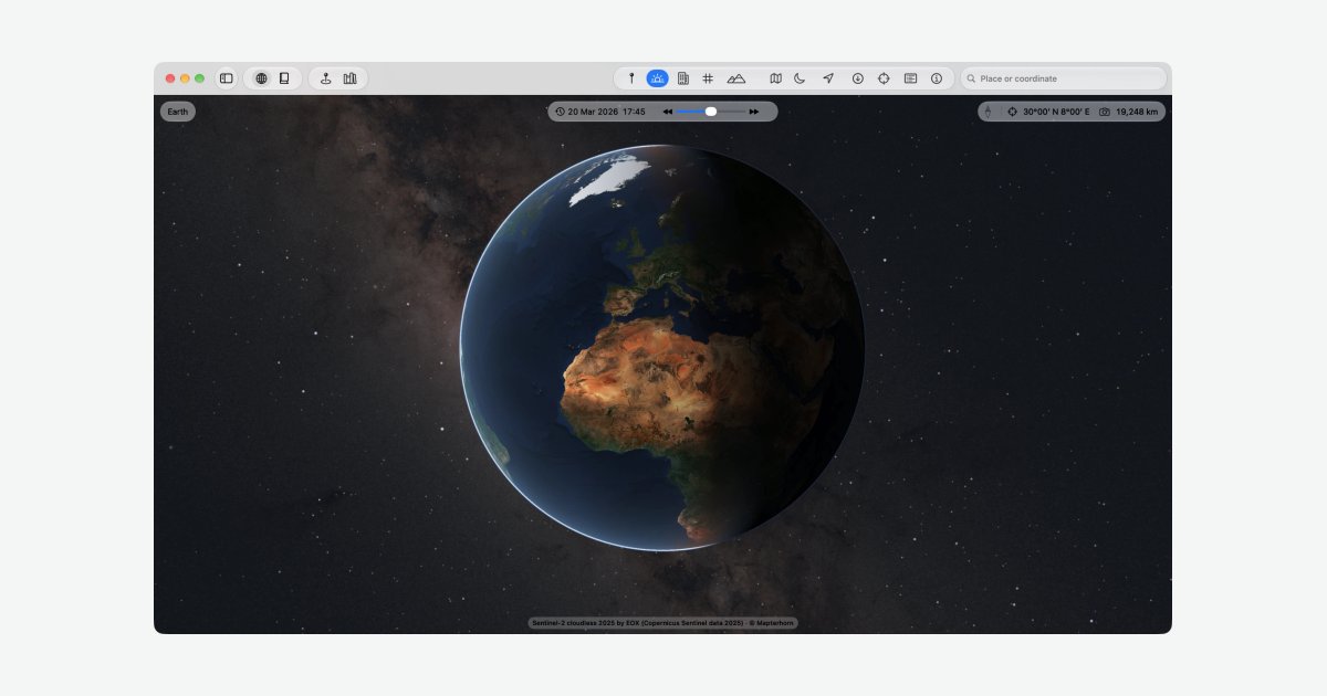
A native globe app for the Mac
Kugelblitz, a Mac application that presents the Earth and its celestial neighbours as both a three-dimensional globe and a classic flat atlas, has drawn attention after landing on Hacker News' front page, where the post framed it as a native alternative to Google Earth for macOS. According to the app's website, every layer it displays is freely available geodata fetched directly from the original publishers, and using the app requires no account.
Three map layers on real terrain
The site describes three base renderings of the planet: imagery, a road map and a topographic map. The two drawn maps are draped over actual terrain elevation rather than shown flat, and buildings appear in three dimensions. A scenes feature lets users jump back to a saved viewpoint in a single move.
Alongside the globe sits an atlas view, invoked with Shift-Command-A, which lays the same data out like a printed sheet in a choice of five map projections, from whole-sheet overviews down to the finest available imagery.
OpenStreetMap streamed on demand
Rather than asking users to download regional extracts or bulky planet files, Kugelblitz serves OpenStreetMap from its own tile server. The website explains that tiles are delivered only for the area currently in view, at a level of detail matched to the viewing distance, so coverage is identical everywhere on Earth. Everything that loads stays in a local cache, and optionally multiple copies of the app on the same network can share that cache with one another.
A library of open map services
A built-in Library, opened with Shift-Command-B, indexes directories and public geoportals offering map services from around the world: aerial and satellite images, elevation models, general maps and 3D building data. Any service can be previewed on the globe straight away, and one click adds it to a personal "My Places" collection.
Flight controls and performance
Navigation accepts several inputs at the same time: keyboard, trackpad and mouse, plus 3Dconnexion's SpaceMouse, which acts as a pressure-sensitive flight controller without needing a separate driver. The developers state the app was built and profiled on a Mac mini with an M1 chip and 16 GB of memory, and that aerial imagery, terrain, buildings, roads and labels render together smoothly even on that machine.
The Mac can also push its rendered globe into an Apple Vision Pro headset through a "Show on Vision Pro" menu command (Option-Command-V), with no app installed on the headset itself — a combination the site says was checked with Mac and headset on version 27.2, working even from an M1.
Eclipses, quakes and a time shuttle
Beyond static cartography, the app includes an events layer. Eclipses spanning 5,000 years are calculated rather than read from precomputed tables, and earthquakes, volcanic eruptions, tsunamis and fireballs are plotted at the place and time they occurred. A time-shuttle control animates these events coming and going over the years.
Provenance in the interface
Status windows report how much of the current view has loaded, where the camera is pointing and which sources the visible data comes from. A dedicated "Sources and Licenses" view lists every data source alongside its license, a notable gesture toward attribution in a field where map data provenance is usually invisible. The interface ships in German and English with user-selectable units.
Why it matters
Google Earth has long been the default way to explore the planet in 3D, but it remains a closed, cross-platform service whose data pipeline is opaque. Kugelblitz stakes out a different position: a Mac-first tool whose entire data layer is open geodata served from its originators, with licensing surfaced directly in the UI. For journalists, researchers and map-curious developers who care where their imagery and vector data actually come from, that transparency — combined with no-account use and shared local caching — is a meaningful alternative model.
The app is also a practical demonstration that a full globe with terrain, 3D buildings and multiple map layers can run smoothly on entry-level Apple Silicon and even drive a Vision Pro without a headset app. Whether a small project can sustain a planet-wide OpenStreetMap tile server as its user base grows is an open question the site does not address. As a showcase for what open geodata can do on the Mac, though, it is one of the more interesting native tool releases in this space.
- #mac
- #maps
- #openstreetmap
- #open-data
- #gis